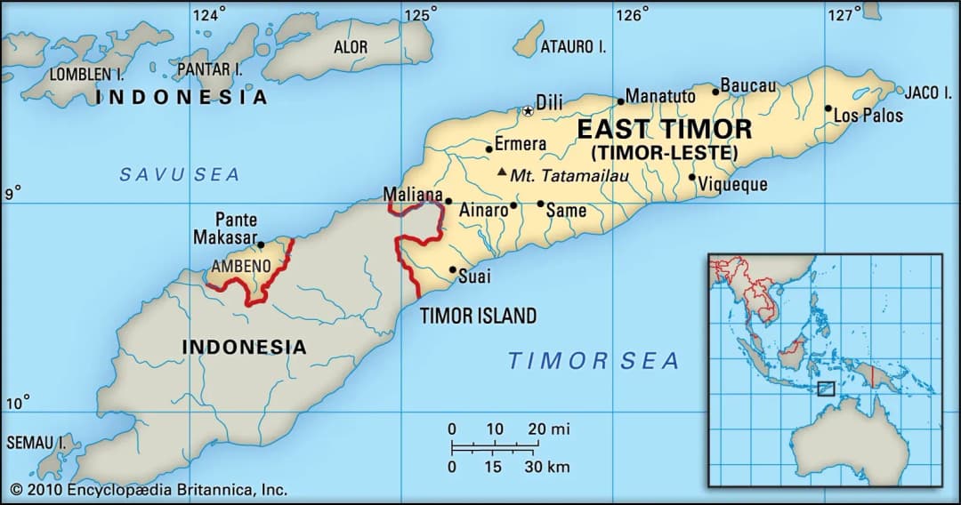
A half-island nation occupying the eastern half of the island of Timor, together with the Oecusse exclave and the islands of Atauro and Jaco; rugged, mountainous and densely forested, with a long tropical coastline.
Total Land Area: 14,874 sq km / 5,743 sq mi
Capital: Dili
GDP (nominal, US$): ≈ US$2.0–2.2 billion (2024–2026)
Global Ranking (GDP): ≈ 180th
Currency: US dollar (USD); Timorese centavo coins in local circulation Fully dollarised — no exchange-rate risk for foreign investors. **Major Economic Sectors: ** _(the non-oil economy is predominantly agrarian; headline sector shares are distorted by petroleum) _
Official Languages: Tetum and Portuguese (Indonesian and English are working languages)
Literacy Rate: ≈ 68% of adults (2021); ≈ 84% of youth aged 15–24
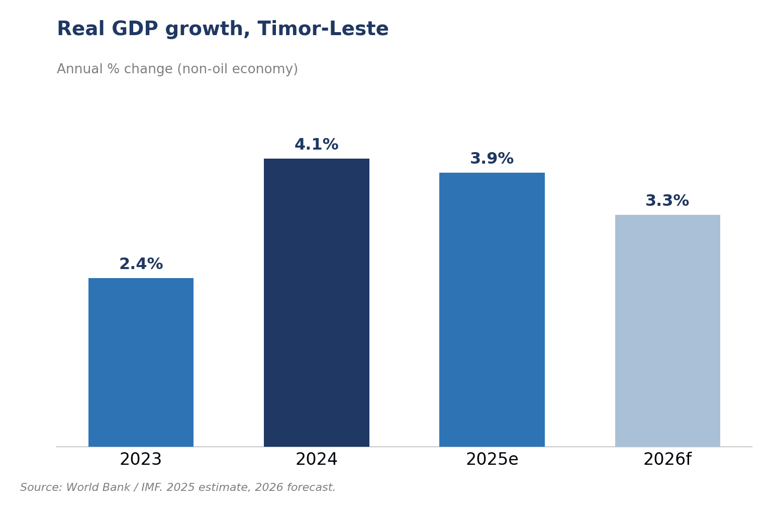
GDP Growth: 2.4% (2023), ≈ 4.1% (2024), ≈ 3.9% (2025)
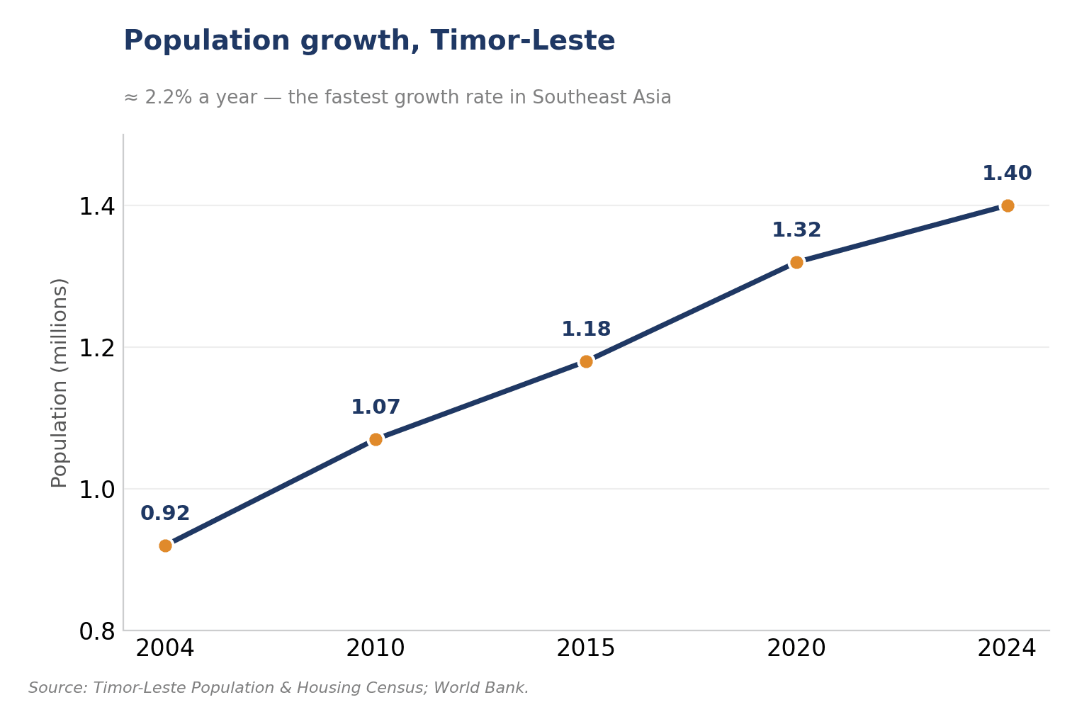
Total Population: ≈ 1.4 million (2024)
A very young, fast-growing population — the highest growth rate in Southeast Asia (≈ 2.2%).
Urban Population: ≈ 33%
Labour Force Participation Rate: ≈ 36% — among the lowest in the region, reflecting a large young and informal workforce Petroleum Fund (Sovereign Wealth Fund): ≈ US$18 billion (≈ 10× annual GDP)
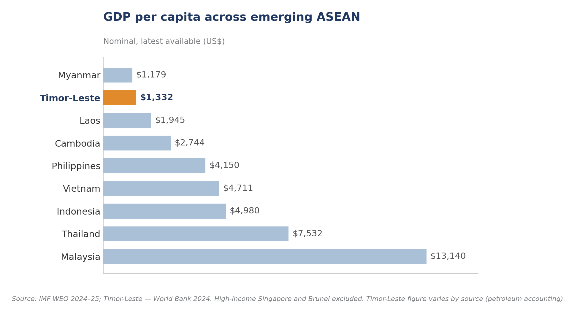
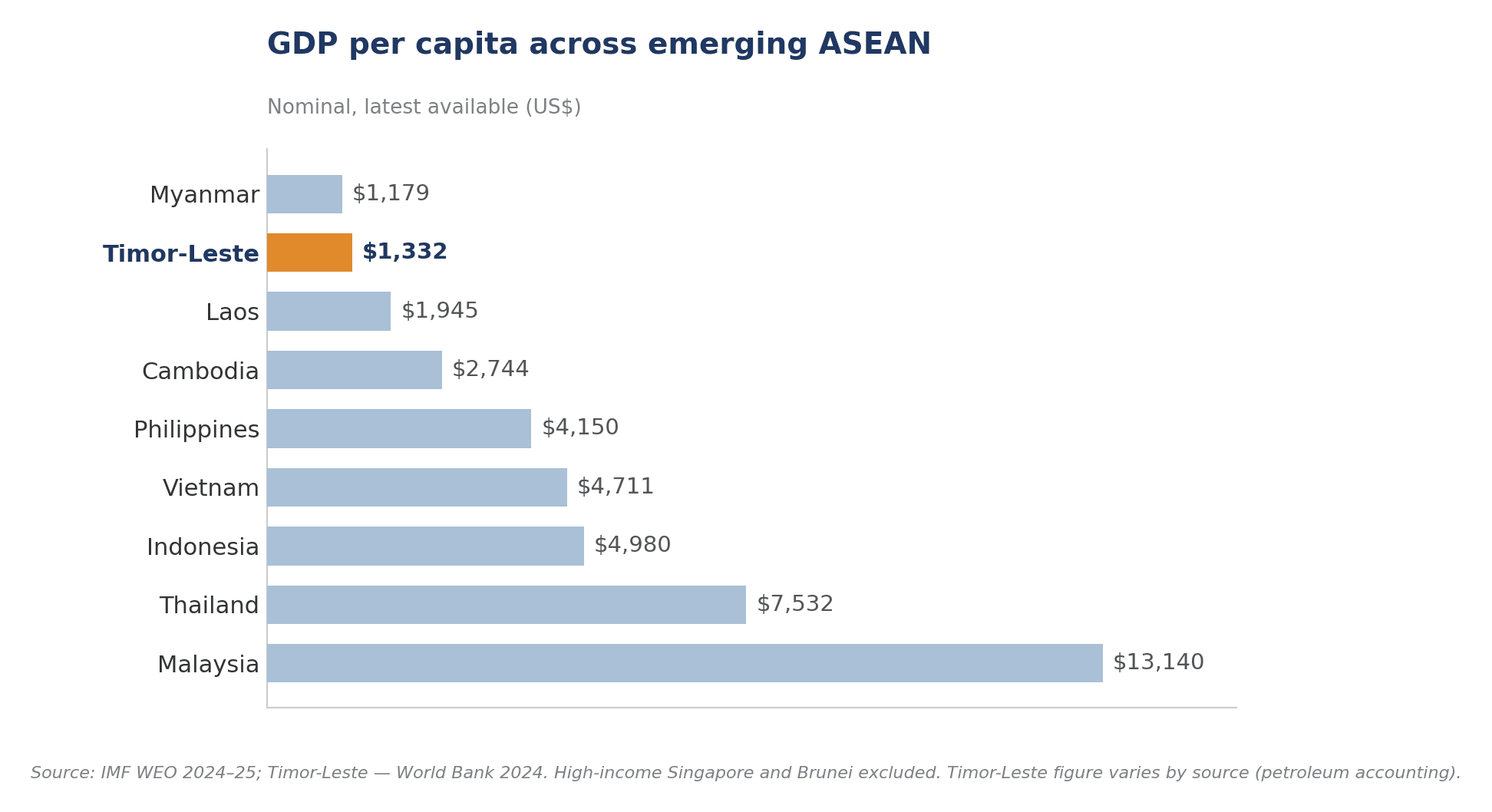
GDP per capita (nominal): ≈ US$1,300–1,550